A century ago Sanborn was the largest map maker in the country. The maps were made for various reasons, but mostly for ôFire Insuranceö as fire was an ever present danger in the old days. Seven of these Sanborn maps are of Raritan. They are from the years 1887, 1892, 1897, 1903, 1910, and 1919. These detailed maps, along with other already known ôAll Buildings Mapsö from 1860, 1873, 1928, and 1948 allow the historian to trace the history of this town in much more detail than ever before.
Links to these maps can be found below.
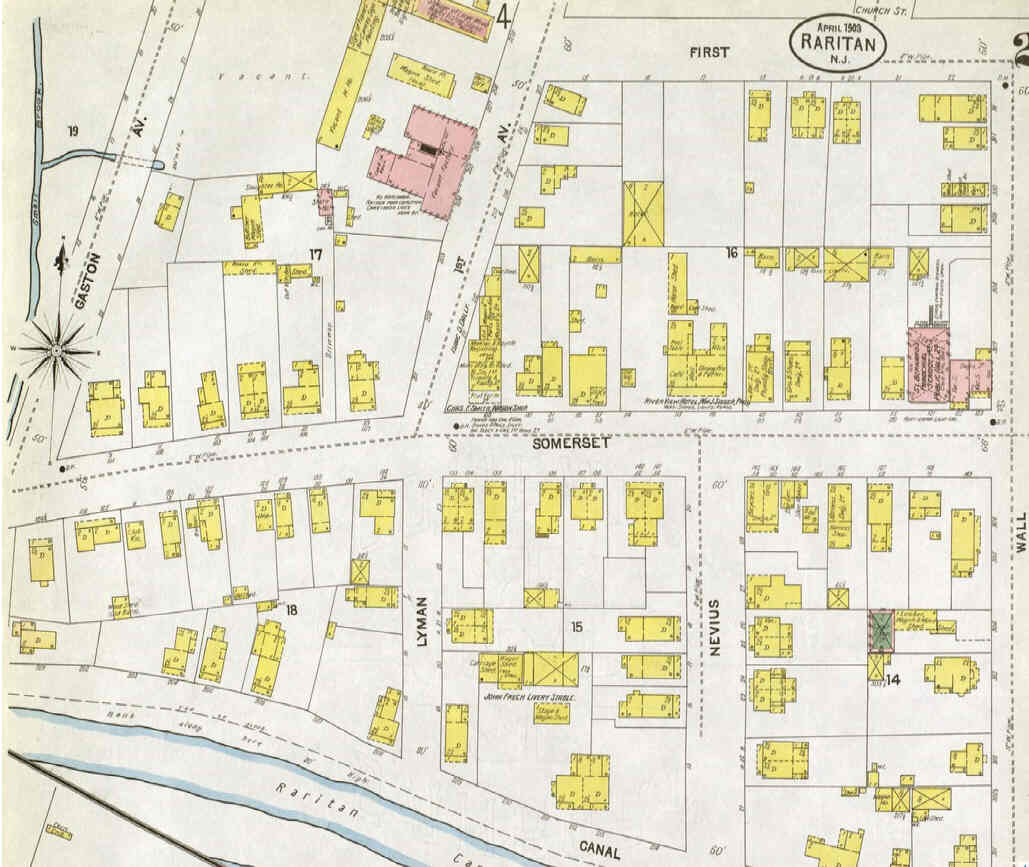
Each successive map shows an increment in the development of the town of Raritan.
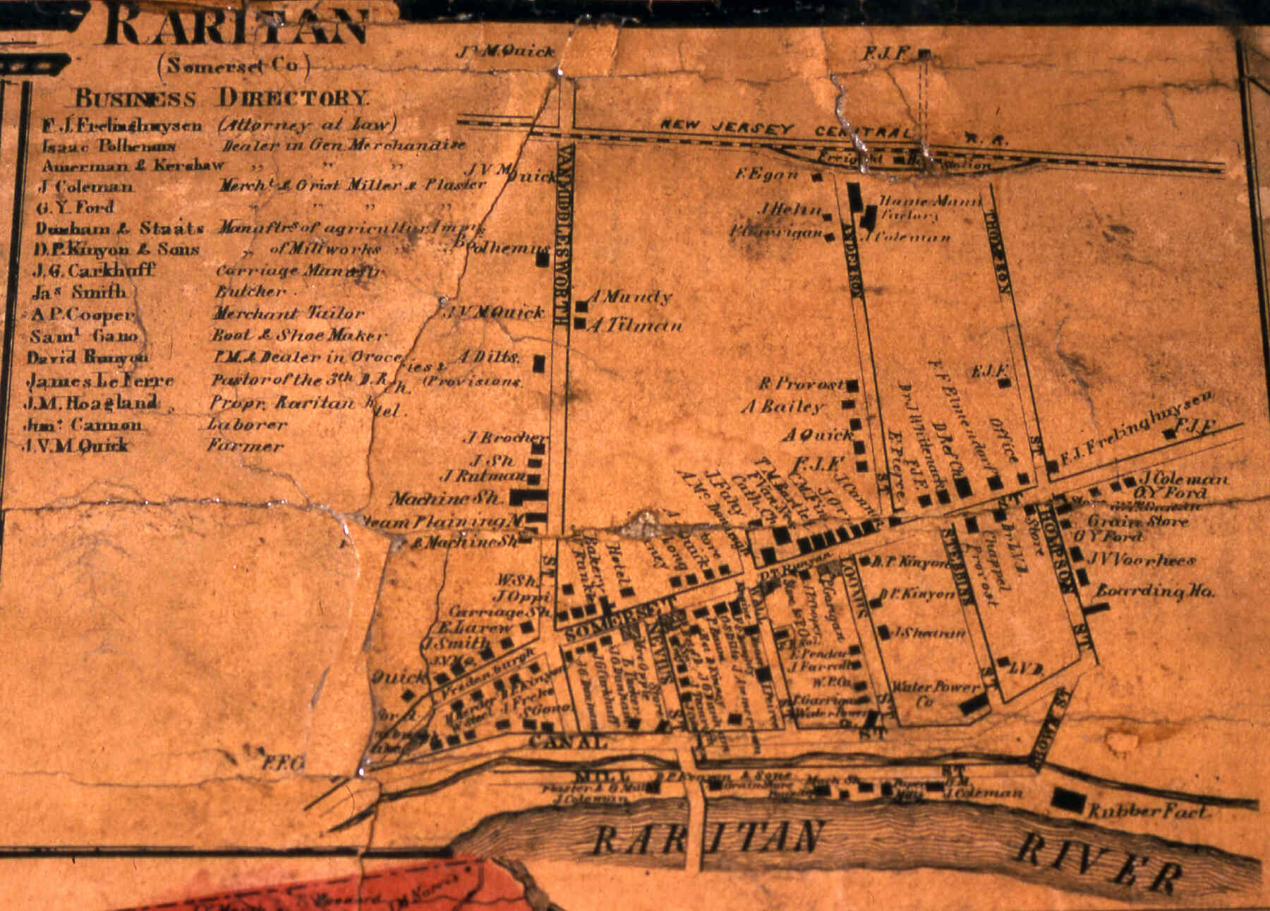
This earliest detailed map of Raritan has been known to historians for years.
It shows buildings along Somerset Street and First Avenue (which was then called Van Middlesworth Ave.).
The Third Reformed Church and St. Bernardĺs Church are present. The map shows that back then it was south of Somerset Street that had most of the houses.
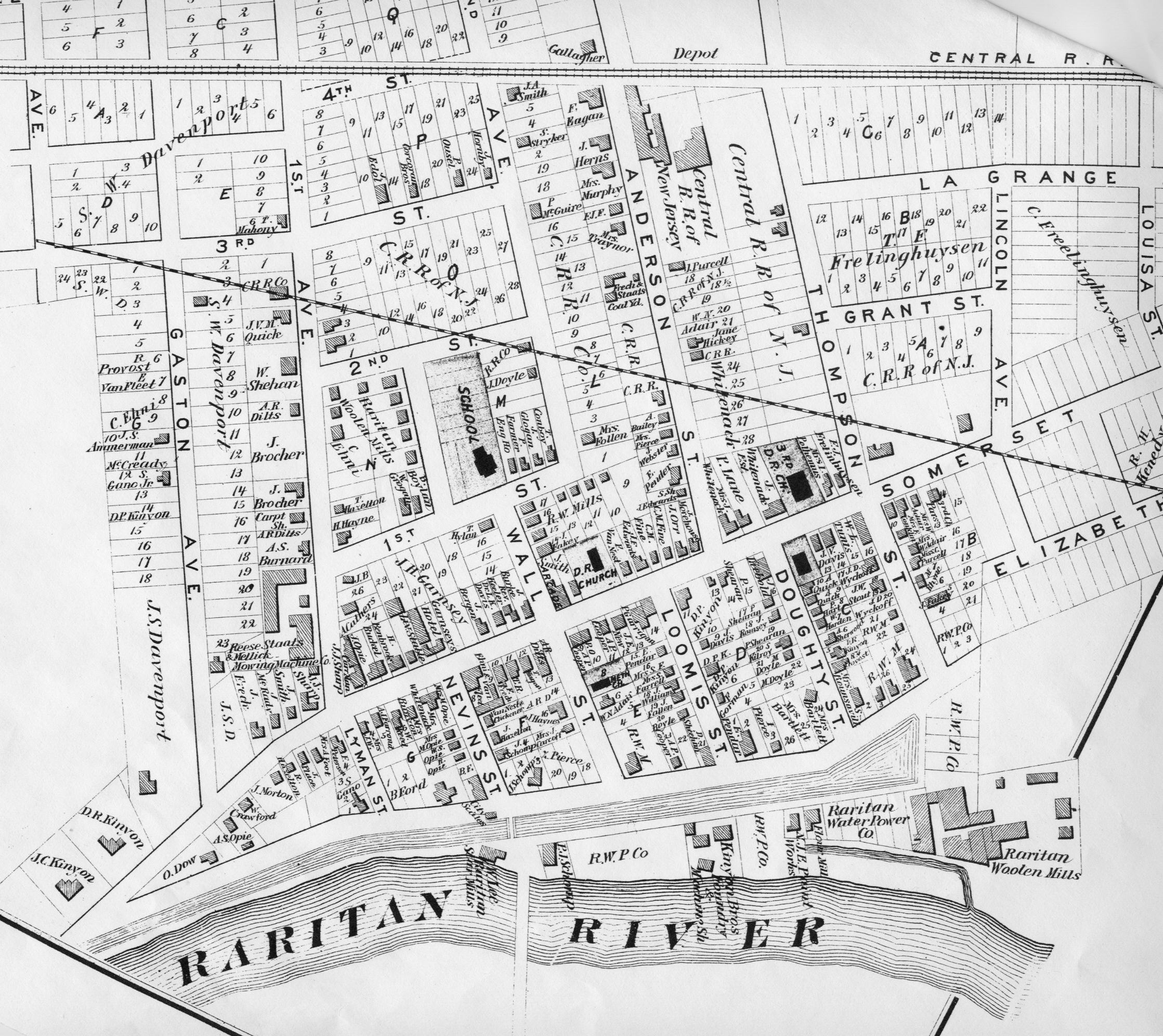
On this map we see the town as we know it today taking shape. In the thirteen years since the previous map (1860) numerous structures were built.
The streets north of Somerset Street - Gaston, First ôStreetö, and Second Street now appear.
There are many buildings on Anderson and Thompson Street.
Dozens of the buildings on this map are still with us today. They include the two large homes across from the Basilone Statue, 7 First Avenue (the recording studio today), and many of the homes on the various side streets such as Nevius and Doughty.
This is the first of the very detailed Sanborn maps. It reveals that many homes of that era had a shed in the back for horses.
The brick row houses are built by then.
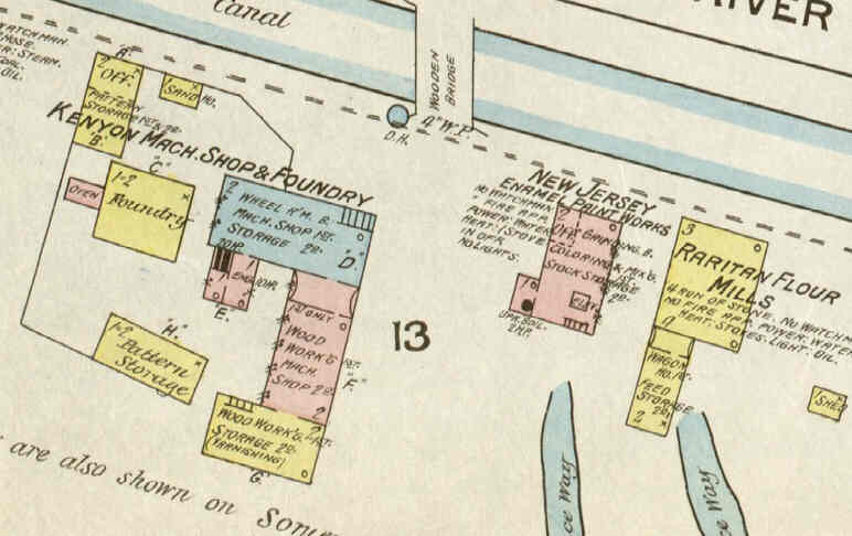
The factories along the river are the Star Grist Mill, New Jersey Enamel Paints, Raritan Flour Mills and Kenyon Machinery.
The train station depot building appears for the first time.
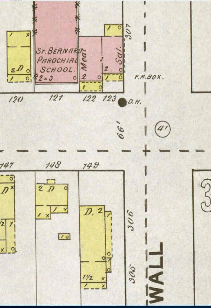
St. Bernardĺs Parochial School (later the VFW) also makes its debut.
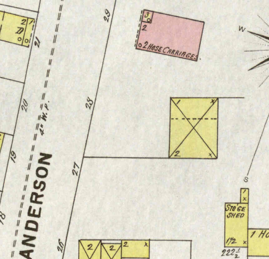
On this map we see the Anderson Street Firehouse for the first time. But First Street does not yet extend to Anderson Street.
A house sits on what later will be the part of First ôStreetö in front of the firehouse.
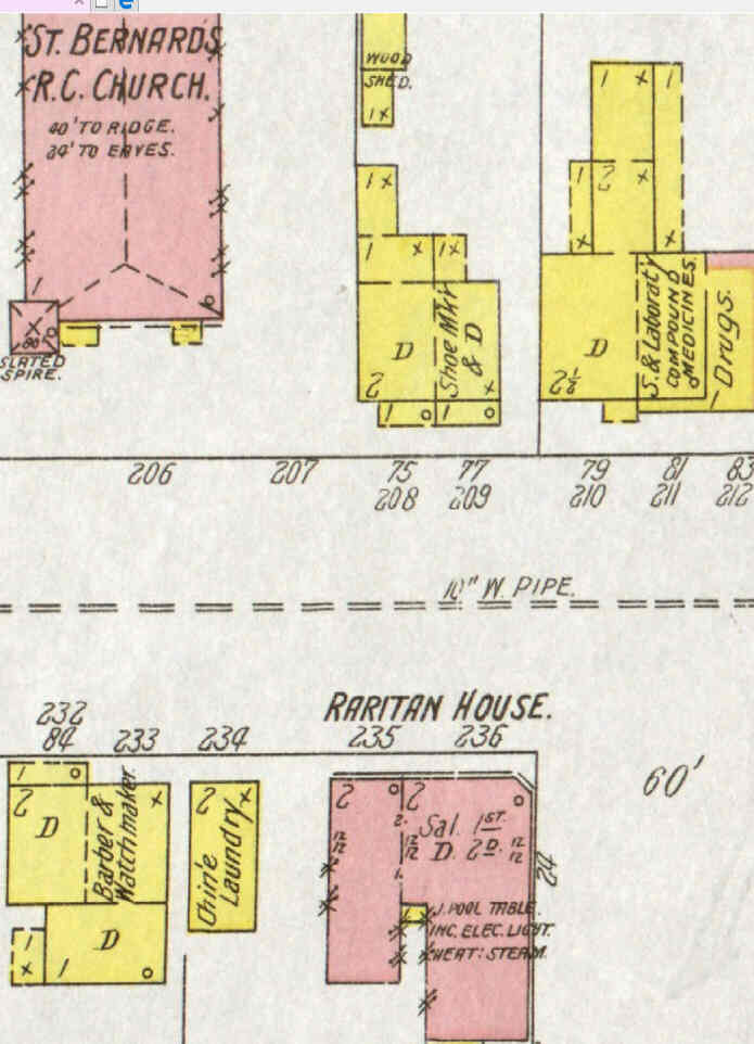
The brick building that today holds ôSafe Haven Computerö is present and it is shown to be a hotel.
The castle by the river - which was a water pumping station for Dukes Estate - makes its debut.
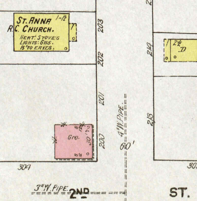
So does St. Annĺs original Church (which was built in 1906).
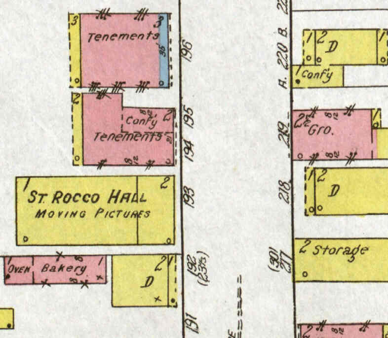
We see for the first time the Raritan Theatre (later the Playhouse) at 23 Anderson Street.
It was also St. Rocco Hall.

One example of that is the North-East corner of Somerset Street and First Avenue ľ where the Quick Chek / The Liquor Savor and their parking lot are today.
The old maps show that in the old days the buildings were situated right along the roads and not set back like today. The property had three sections to it - West, Middle, & East.
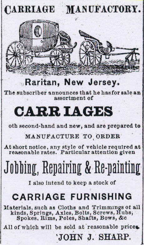
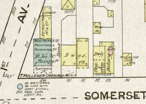
While the owner would change over the decades ľ starting with Carkhuff in 1860, then John Sharp in 1873, T. Mullener in 1887, and later Chas Smith ľ the location remained a carriage manufacturing and carriage repair shop for fifty years.
Other related businesses would accompany the shop.
We see on the Sanborn maps that blacksmithing, wheelwrights work and bicycle repair were also done there.
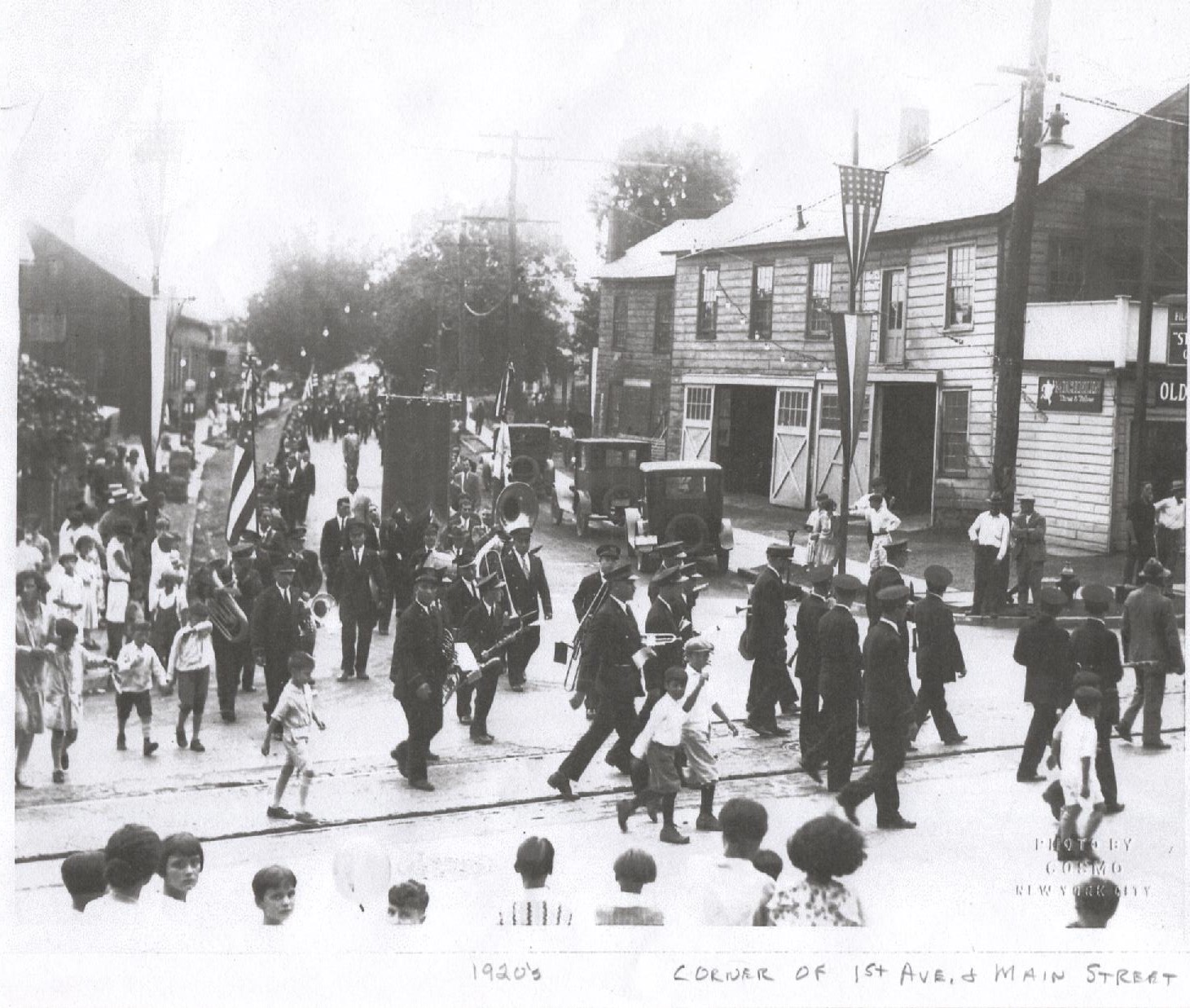
In 1936 Joseph Lipoma would take ownership of the auto repair shop. During his tenure the upstairs was a meeting place that could be used for social gatherings. The Post War Club met there in the 1950s. Lipomaĺs Garage was a busy shop that was a vital part of the community. Todayĺs older Raritan residents all remember the place. Around 1961 Lipomaĺs Garage closed and was knocked down afterward.
Two were houses 1860-1960 and the other building had a bakery from 1860 till at least 1922 and after that it was a small apartment building.
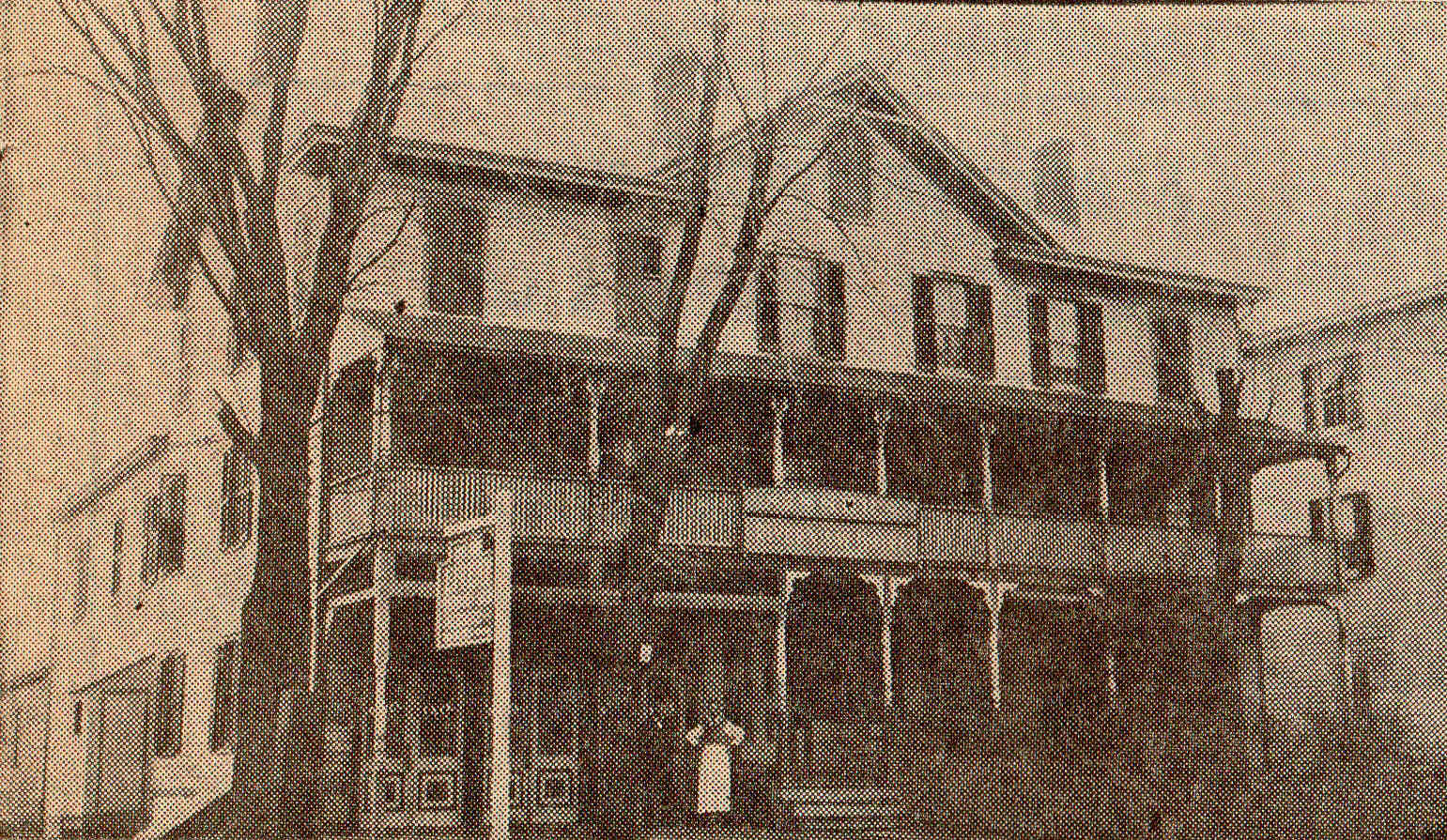
The Sanborn map shows that the hotel had a dining room, parlor room, pool table room, and a cafÚ. In its later years (on the 1919 map) a previously forgotten bowling alley was in the back. The path of the bowling lanes ran perpendicular to Somerset Street which would take it through the liquor store today.
Prohibition, which started in 1920, put the hotel out of business and the 1928 Sanborn map shows no hotel in that location.
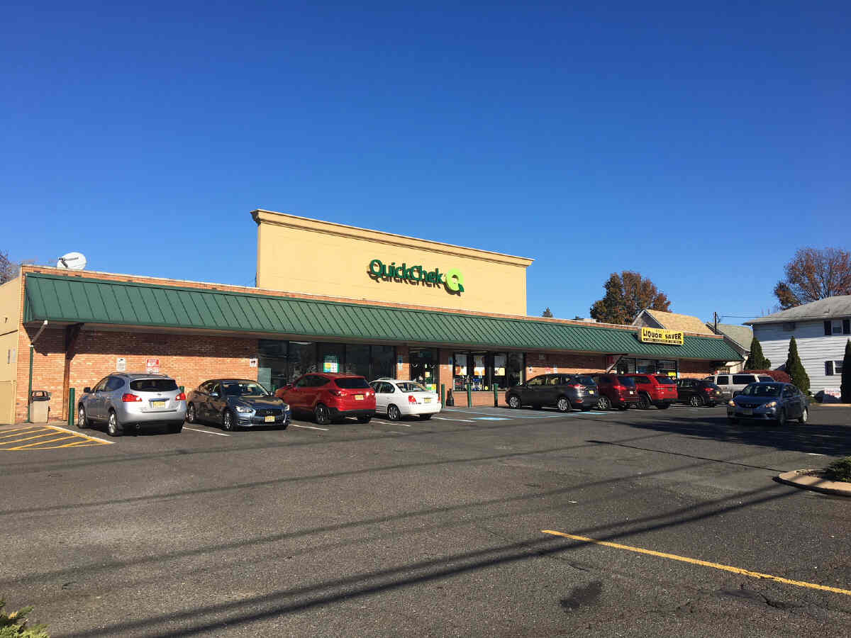
The Quick Chek would open there around 1970.